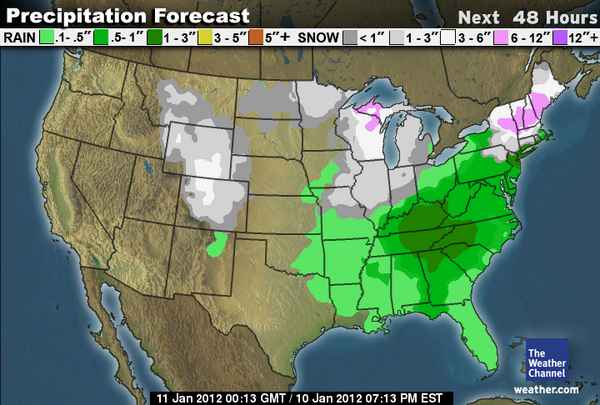
Last week we talked about another weak storm sliding down the Rockies for the middle of this week. The light snow began to move in overnight from Montana down to Idaho and Wyoming bringing only a dusting of snow to most locations, maybe a couple of inches for Jackson. The snow will continue to push today through Utah and Colorado.
Only expecting a dusting in Utah but over Colorado we will see amounts of 2-4 inches across most of the mountains. The exception will be the Southwest corner near Telluride where only a dusting is expected. On the highest peaks of North Central Colorado near Steamboat we could see as much as 3-6 inches. The cold front pushing through will bring lots of cold air with highs only in the single digits and teens for today.
Here is the 48 hour WC snowfall forecast map.
After this weak storm the temperatures quickly rebound into the 30’s by the weekend as the weather becomes quiet for about a week. The forecast models have been suggesting that the storm track shifts to the West Coast starting the middle of next week. That would mean the storms would come East through the Rockies as well starting the middle of next week.
The change in the pattern next week replaces the trough over Alaska with a ridge and pushes the storm track South into the West Coast. The only question is how far down the West coast does the storm track setup? The key will be the exact position of the ridge up near Alaska. The difference would be a little further West over the Bering Sea then the ridge could build again off CA keeping the storm track up into the Pacific NW.
For the Rockies the differences could be only snow for the Northern Rockies with a further North storm track or further South into Colorado with a storm track further South. Either way it looks like the storm activity will pick up for at least the Northern half of the Rockies from the middle of next week into the following week.
Here is the total precip map from the GFS forecast model through this Saturday which only shows the weak storm from today.
But look at the precip over the following ten days….
You can see the Pacific NW and maybe further South into CA will get the brunt. Further East that would be several feet for Idaho, a few feet for Jackson, and a couple of feet down into Colorado. We still need to wait until the end of the week and into the weekend to see where the models have the storm track for next week to start talking about and specific snowfall forecasts. But you can see the overall trend right now is for the pattern to become more active and snowy. BA


