Report From Powderchasers
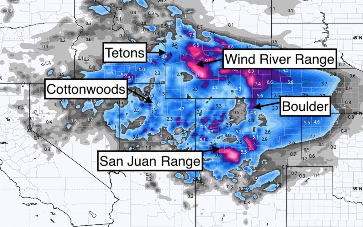
White Turkey? The next storm begins up north on Turkey ![]() Day. Highlights include central Wyoming, southern San Juan range and N Utah (wildcard). We will be issuing a forecast on our webpage shortly. Please support powderchasers.
Day. Highlights include central Wyoming, southern San Juan range and N Utah (wildcard). We will be issuing a forecast on our webpage shortly. Please support powderchasers. ![]() #forecast#snow#powder#powderchasers#pow#snowforest#powforever@tirerack@selkirkpowder@ikonpass
#forecast#snow#powder#powderchasers#pow#snowforest#powforever@tirerack@selkirkpowder@ikonpass![]()
![]()
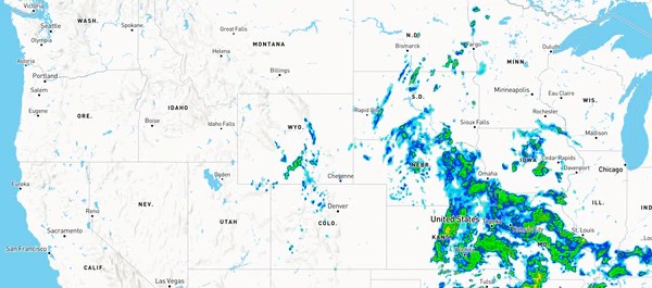
The last storm has departed the Rockies Monday with some light snow showers still falling over the Continental Divide in Colorado (I-70 corridor).
Below: Departing low over Kansas currently with some light snow over Colorado and southern Wyoming early Monday morning.
The system that originated off the California Coast led to many forecast changes as it swept south along coastal areas depleting most of its moisture before heading inland over the Sierra range.
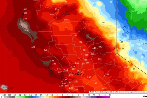
The initial models had a bullseye over the Sierra with 2-3 feet of snow before backing off to almost nothing. Then what happened? Model flip flops. Forecasts kept changing.
In the preceding 48 hours before moving inland from southern CA, the models suddenly jumped up again showing 11-15 inches for many ski areas in the Sierra range especially the west side of Lake Tahoe. Unfortunately. warmer temps keep snowfall totals much lower than expected and most resorts only picked up 4-8 inches. It is possible that higher amounts will be reported at the summits. Palisades automated telemetry showed 8 inches at 8,000 feet.
Below: On November 9th the National Blended Model (Automated and tweaked by the National Weather Service) showed a significant dump for the Sierra. We specifically said “Our confidence is low”. It is interesting to look back at model runs. This would have been a grand slam for the Sierra Range!
Mammoth as we originally forecasted was the winner at around 8-10 inches. The amounts we forecasted near Lake Tahoe was overdone. The next few weeks does not look great either for the Sierra range. Don’t panic! We have seen the Sierra come back from Zero to Hero in a short period of time (Many of the last few seasons).
Meanwhile in the PNW cold air kicked off 4-8 inches in the Cascades skirting north of Oregon (Bust forecast),. and combined with moisture from the CA storm over Nevada. We suspect the Ruby mountains near Elko NV may have scored some deep powder.
The Big Totals!
The Wasatch delivered as we forecasted with 12-18 inches of snow for LCC (4-10 estimated in BCC). One surprise was that the Canyons side of Park City that often does well with NW flow pushing over the ridges of the Cottonwoods only saw 3 inches (Bust). Light winds until the tail end of the storm may have been responsible for this. Beaver Mountain who we highlighted in a previous forecast grabbed 5-7 inches with an unofficial snow report. Support local family run ski areas! Beaver has not announced an opening date yet.
Below: Little Cottonwood Canyon Sunday morning. Photo @powderchasersteve -Instagram. 15 plus storm totals by late Sunday night.
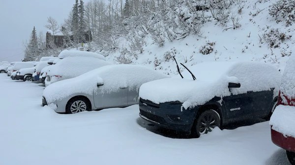
Colorado scored the deepest snow on the western slope as forecasted (Powderhorn, Aspen, Snowmass), followed by lighter amounts further east near the Divide. This low tracked south over the western side of Colorado.
Powderhorn picked up nearly 10 inches with Snowmass close behind. Vail snuck out 6 inches as well as Telluride who we also suspected would grab freshies (Northern San Juan Range). New Mexico saw drier leftovers with just a few inches. Areas near Wolf Creek saw less snow.
Below: Powderhorn near Grand Junction scored the most snowfall in Colorado (Western Slope). That was highlighted in our original forecasts (Boom).
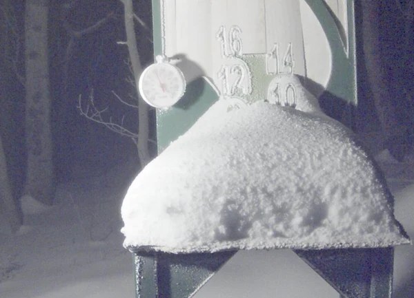
Below: Automated Telemetry at Patrol HQ at Telluride shows 6.5 inches (Unofficial).

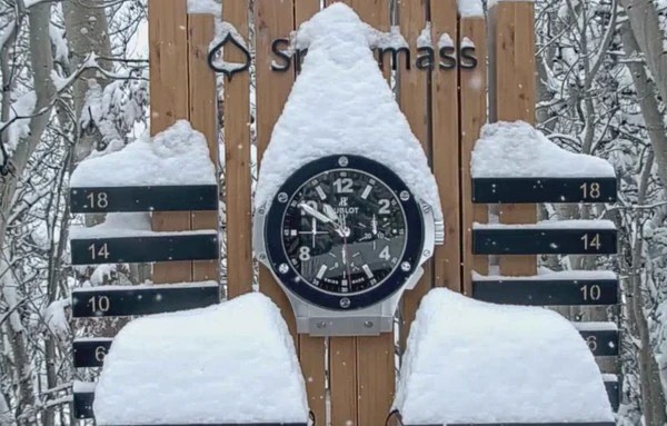
Below: Snowmass scored nearly 10 inches on the webcam with perhaps higher amounts at the summit. Videos of hike for turns looked great.
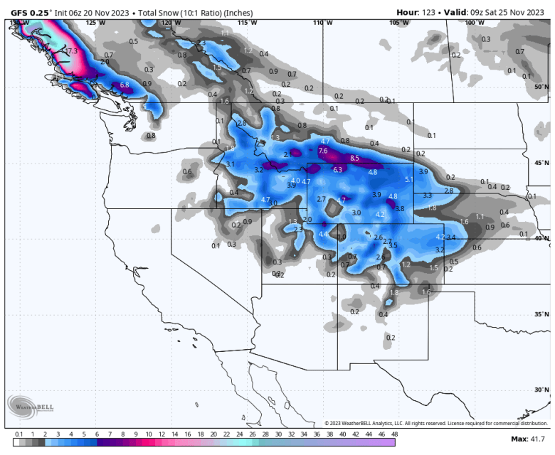
The extended outlook has another storm that moves down from Canada with very cold air and some moisture. This will kick off widespread snowfall favoring the Rockies from MT, ID, WY, UT, and Colorado near or just after Turkey Day. It is possible someone sees a white turkey.
Extended Outlook.
Very cold air will stream into the Rockies by Thanksgiving with a low-pressure system that might stall over the Rockies by Thursday/Friday. It is unclear on the exact track of this low. This system as opposed to the last one, will originate up north and spread over Montana/Wyoming/Idaho/Utah and Colorado. New Mexico may also be in the mix.

Sponsor Alert: This post is sponsored by Skis.com and Snowboards.com. Powderchasers supports them being family-owned and with a vast selection of quality gear and clothing. We will donate a PC tee shirt for every purchase over $200 (Email us). They have an incredible selection. Please support them.
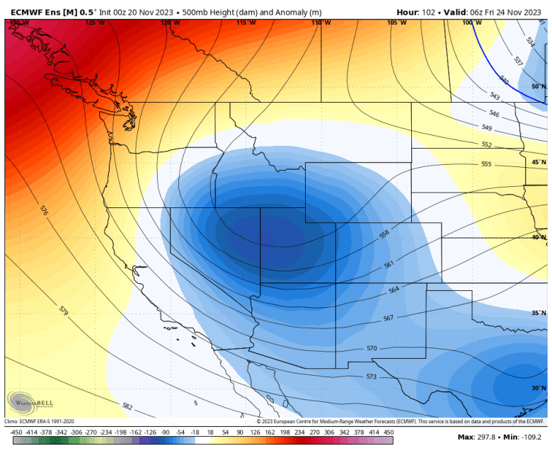
Below: Low pressure over the Intermountain West (Rockies) by Thursday night/Friday night- November 23/24/25 (North to south).
Below: Cold front dropping due south from Canada over a wide area of the Rockies. This might pass just to the east of the western Cascade Range and the Sierra and focus on the Rockies. Snowfall will accompany this front. Temps are at 10K feet in Celcius (-14C or 6F). Single digits at the summits.
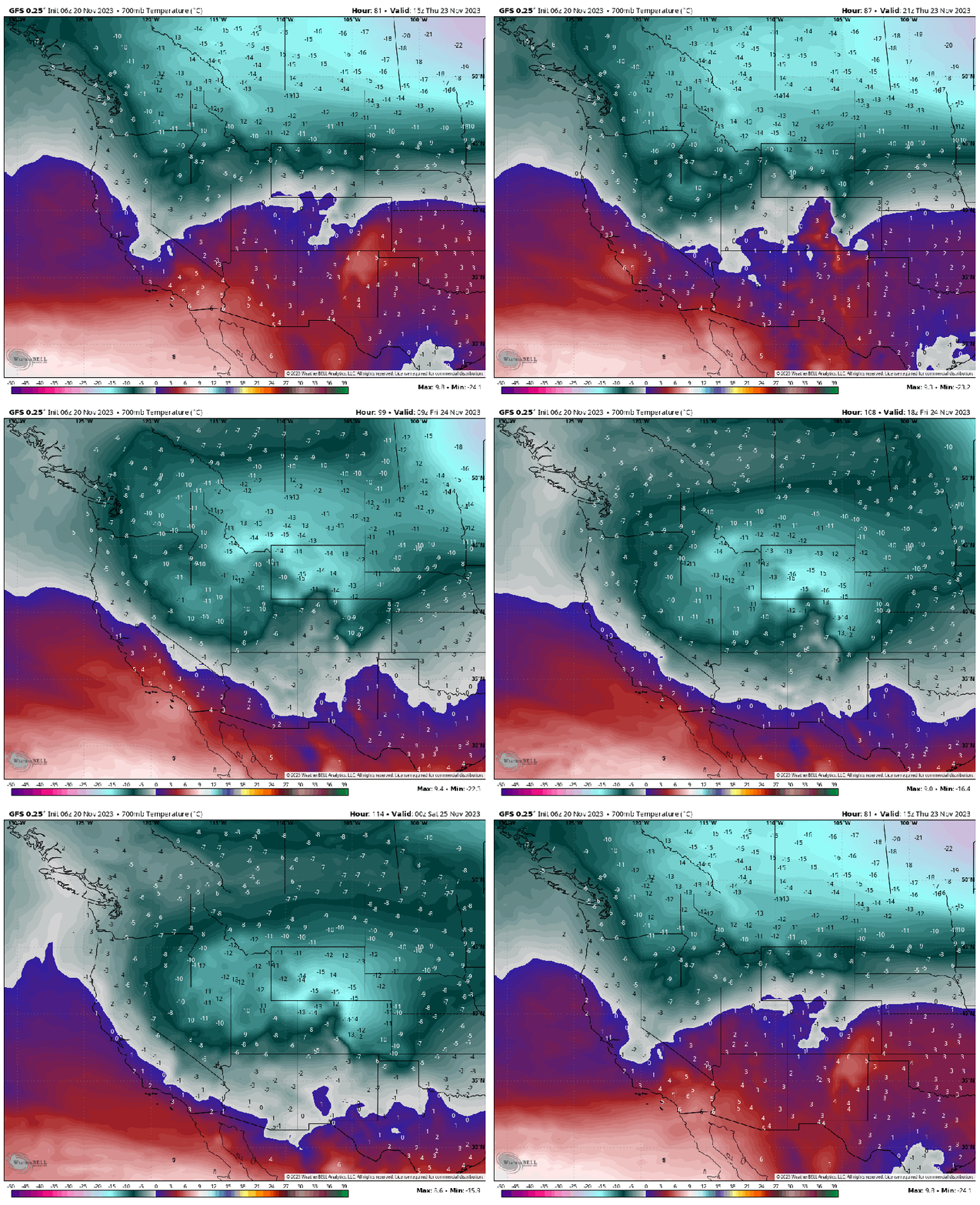
Below: American Model favoring Idaho/Wyoming/Utah/Colorado. The European is even deeper but not shown here. It’s too far out to have confidence in amounts. Timing: Thursday night to Saturday(North to south). This should be a decent storm (My early forecast with low confidence is 5-10). If it cuts off and stalls, amounts could be higher. Cold temps will enhance snow-making and snow ratios. Need more time to improve accuracy.
Beyond the late week storm, we migrate to high pressure before another system moves in around November 30th.
you can follow my world travels and photography on Instagram @powderchasersteve
Announcement: Please join our concierge program to support powderchasers. This program provides 1:1 forecasting, chase locations, and custom trip planning to get you in the deepest snow of the season.This includes Europe and S. America. You can also donate on our website or purchase some swag to support us. Send us a donation of $100 or more and we will ship you some swag (Shirt and stickers).
Powderchaser Steve

